EUPreciPBench datasets
The EUPreciPBench datasets are available on a small portion of Europe stored in Zarr format for an easy access allowing for slicing. The forecasts and observations datasets are already paired together, providing analysis-ready data for postprocessing benchmarking purposes.
It is a forecasts and observations dataset on a regular latitude-longitude grid, containing high-resolution precipitation data, along with some predictors in the column above the surface. It’s horizontal resolution is higher (0.025°) than the one of the EUPPBench datasets (0.25°), but they are conveniently defined on the same domain.
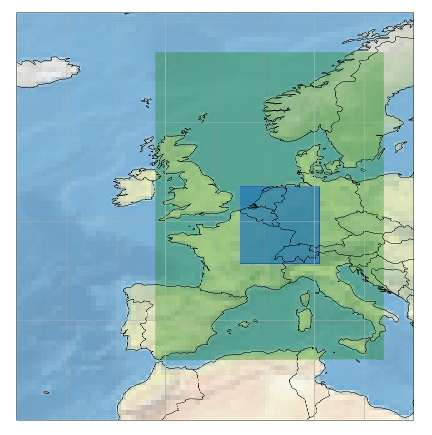
In blue, the EUPreciPBench dataset domain inside the Base datasets over Europe’s domain.
The gridded EUPPreciBench postprocessing benchmark dataset contains COSMO DE and D2 ensemble forecasts over a small domain in Europe, from 46.0° to 53.2° in latitude, and from 2.5° to 10.4° in longitude, and covers the years 2017-2020.
It also contains the corresponding EURADCLIM radar composite for the purpose of providing observations for the benchmark.
The forecasts provided are the COSMO runs initialized at 03Z.
The COSMO ensemble consists of 20 members.
The gridded data resolution is 0.025° x 0.025° which corresponds roughly to 2.5 kilometers. COSMO DE, D2 and EURADCLIM data have been regridded to this resolution from their native grid.
COSMO DE forecasts (prior to May 2018) only covers part of the EUPPBench domain. COSMO D2 forecasts cover the full EUPPBench domain.
Forecasts are hourly, up to 2 days ahead, but do not include the analysis at 03Z.
Datasets description
There are 3 gridded sub-datasets:
1 - Precipitation Forecasts Data
It consists in the total precipitation variable accumulated in the past hour:
Parameter name |
ECMWF key |
Units |
Remarks |
|---|---|---|---|
tp |
mm |
Warning
The units for the total precipitation here are not consistent with the EUPPBench datasets total precipitation units. As the latter uses meters as units, there is a factor 1000 between the two.
Warning
Please note that, although we use the ECMWF key tp to name the variable, here it represents the total accumulated precipitation over the previous hour, and not since the start of the forecast simulation, as is usually the case for the ECMWF variable tp.
Usage: The precipitation forecasts can be retrieved by calling
import climetlab as cml
ds = cml.load_dataset('EUPreciPBench-gridded-precipitation-forecasts')
ds.to_xarray()
Alternatively, one can use the Intake catalogue
import euppbench_datasets
cat = euppbench_datasets.open_catalog()
ds = cat.euprecipbench.EUPreciPBench_precipitation_forecasts.to_dask()
Example:
import climetlab as cml
ds = cml.load_dataset('EUPreciPBench-gridded-precipitation-forecasts')
ds.to_xarray()
By downloading data from this dataset, you agree to the terms and conditions defined at

    https://github.com/Climdyn/climetlab-eumetnet-postprocessing-benchmark/blob/main/DATA_LICENSE

If you do not agree with such terms, do not download the data.
<xarray.Dataset>
Dimensions:     (latitude: 289, longitude: 317, number: 20, step: 45,
                 surface: 1, time: 1440)
Coordinates:
  * latitude    (latitude) float64 46.0 46.02 46.05 46.07 ... 53.15 53.17 53.2
  * longitude   (longitude) float64 2.5 2.525 2.55 2.575 ... 10.35 10.37 10.4
  * number      (number) int64 1 2 3 4 5 6 7 8 9 ... 12 13 14 15 16 17 18 19 20
  * step        (step) timedelta64[ns] 01:00:00 02:00:00 ... 1 days 21:00:00
  * surface     (surface) float64 0.0
  * time        (time) datetime64[ns] 2017-01-01T03:00:00 ... 2020-12-31T03:0...
    valid_time  (time, step) datetime64[ns] ...
Data variables:
    tp          (time, step, number, surface, latitude, longitude) float32 ...
Attributes:
    Conventions:             CF-1.7
    GRIB_centre:             edzw
    GRIB_centreDescription:  Offenbach
    GRIB_edition:            2
    GRIB_subCentre:          255
    history:                 2025-02-10T04:45 GRIB to CDM+CF via cfgrib-0.9.1...
    license:                 Creative Commons Attribution 4.0
producer: Deutsche Wetterdienst (DWD), Offenbach2 - Predictors Forecasts Data
It consists of several forecasts fields on pressure levels:
Parameter name |
Levels |
ECMWF key |
Units |
Remarks |
|---|---|---|---|---|
500, 700, 850 |
t |
K |
||
700, 950 |
u |
m s^-1 |
||
700, 950 |
v |
m s^-1 |
||
700, 850, 950 |
r |
% |
These fields can for example be used to compute the Jefferson instability index and used as predictors for postprocessing the precipitation ensemble forecasts.
Usage: The predictors forecasts can be retrieved by calling
import climetlab as cml
ds = cml.load_dataset('EUPreciPBench-gridded-predictors-forecasts')
ds.to_xarray()
Alternatively, one can use the Intake catalogue
import euppbench_datasets
cat = euppbench_datasets.open_catalog()
ds = cat.euprecipbench.EUPreciPBench_predictors_forecasts.to_dask()
Example:
ds = cml.load_dataset('EUPreciPBench-gridded-predictors-forecasts')
ds.to_xarray()
By downloading data from this dataset, you agree to the terms and conditions defined at

    https://github.com/Climdyn/climetlab-eumetnet-postprocessing-benchmark/blob/main/DATA_LICENSE

If you do not agree with such terms, do not download the data.
<xarray.Dataset>
Dimensions:        (isobaricInhPa: 4, latitude: 289, longitude: 317,
                    number: 20, time: 1439, step: 45)
Coordinates:
  * isobaricInhPa  (isobaricInhPa) float64 500.0 700.0 850.0 950.0
  * latitude       (latitude) float64 46.0 46.02 46.05 ... 53.15 53.17 53.2
  * longitude      (longitude) float64 2.5 2.525 2.55 2.575 ... 10.35 10.37 10.4
  * number         (number) int64 1 2 3 4 5 6 7 8 9 ... 13 14 15 16 17 18 19 20
  * step           (step) timedelta64[ns] 01:00:00 02:00:00 ... 1 days 21:00:00
  * time           (time) datetime64[ns] 2017-01-01T03:00:00 ... 2020-12-31T0...
    valid_time     (time, step) datetime64[ns] ...
Data variables:
    r              (time, step, number, isobaricInhPa, latitude, longitude) float32 ...
    t              (time, step, number, isobaricInhPa, latitude, longitude) float32 ...
    u              (time, step, number, isobaricInhPa, latitude, longitude) float32 ...
    v              (time, step, number, isobaricInhPa, latitude, longitude) float32 ...
Attributes:
    Conventions:             CF-1.7
    GRIB_centre:             edzw
    GRIB_centreDescription:  Offenbach
    GRIB_edition:            2
    GRIB_subCentre:          255
    history:                 2025-04-03T19:03 GRIB to CDM+CF via cfgrib-0.9.1...
    license:                 Creative Commons Attribution 4.0
producer: Deutsche Wetterdienst (DWD), Offenbach3 - CAPE ML Forecasts Data
It consists of the Convective Available Potential Energy computed on mean layer. For more details about this variable, please follow this link.
Parameter name |
ECMWF key |
Units |
Remarks |
|---|---|---|---|
cape_ml |
J kg-1 |
Usage: The CAPE ML forecasts can be retrieved by calling
import climetlab as cml
ds = cml.load_dataset('EUPreciPBench-gridded-cape-ml-forecasts')
ds.to_xarray()
Alternatively, one can use the Intake catalogue
import euppbench_datasets
cat = euppbench_datasets.open_catalog()
ds = cat.euprecipbench.EUPreciPBench_cape_ml_forecasts.to_dask()
Example:
ds = cml.load_dataset('EUPreciPBench-gridded-cape-ml-forecasts')
ds.to_xarray()
By downloading data from this dataset, you agree to the terms and conditions defined at

    https://github.com/Climdyn/climetlab-eumetnet-postprocessing-benchmark/blob/main/DATA_LICENSE

If you do not agree with such terms, do not download the data.
<xarray.Dataset>
Dimensions:     (time: 1320, step: 45, number: 20, latitude: 289, longitude: 317)
Coordinates:
  * latitude    (latitude) float64 46.0 46.02 46.05 46.07 ... 53.15 53.17 53.2
  * longitude   (longitude) float64 2.5 2.525 2.55 2.575 ... 10.35 10.37 10.4
  * number      (number) int64 1 2 3 4 5 6 7 8 9 ... 12 13 14 15 16 17 18 19 20
  * step        (step) timedelta64[ns] 01:00:00 02:00:00 ... 1 days 21:00:00
  * time        (time) datetime64[ns] 2017-05-01T03:00:00 ... 2020-12-31T03:0...
Data variables:
    cape_ml     (time, step, number, latitude, longitude) float32 ...
    valid_time  (time, step) datetime64[ns] ...
Attributes:
    Conventions:             CF-1.7
    GRIB_centre:             edzw
    GRIB_centreDescription:  Offenbach
    GRIB_edition:            2
    GRIB_subCentre:          255
    history:                 2025-09-21T19:05 GRIB to CDM+CF via cfgrib-0.9.1...
    license:                 Creative Commons Attribution 4.0
producer: Deutsche Wetterdienst (DWD), Offenbach4 - Precipitation Observations Data
It consists in the total precipitation variable accumulated in the past hour:
Parameter name |
ECMWF key |
Units |
Remarks |
|---|---|---|---|
tp |
mm |
Warning
The units for the total precipitation here are not consistent with the EUPPBench datasets total precipitation units. As the latter uses meters as units, there is a factor 1000 between the two.
Usage: The precipitation observations can be retrieved by calling
import climetlab as cml
ds = cml.load_dataset('EUPreciPBench-gridded-precipitation-observations')
ds.to_xarray()
Alternatively, one can use the Intake catalogue
import euppbench_datasets
cat = euppbench_datasets.open_catalog()
ds = cat.euprecipbench.EUPreciPBench_EURADCLIM_observations.to_dask()
Example:
ds = cml.load_dataset('EUPreciPBench-gridded-precipitation-observations')
ds.to_xarray()
By downloading data from this dataset, you agree to the terms and conditions defined at

    https://github.com/Climdyn/climetlab-eumetnet-postprocessing-benchmark/blob/main/DATA_LICENSE

If you do not agree with such terms, do not download the data.
<xarray.Dataset>
Dimensions:     (latitude: 289, longitude: 317, step: 45, time: 1440)
Coordinates:
  * latitude    (latitude) float64 46.0 46.02 46.05 46.07 ... 53.15 53.17 53.2
  * longitude   (longitude) float64 2.5 2.525 2.55 2.575 ... 10.35 10.37 10.4
  * step        (step) timedelta64[ns] 01:00:00 02:00:00 ... 1 days 21:00:00
  * time        (time) datetime64[ns] 2017-01-01T03:00:00 ... 2020-12-31T03:0...
    valid_time  (time, step) datetime64[ns] ...
Data variables:
    tp          (time, step, latitude, longitude) float32 ...
Attributes:
    license:          Creative Commons Attribution 4.0
    product name:     EURADCLIM 1 hour accumulated radar precipitation data
    product version:  2.0
    source:           KNMI
webpage: https://dataplatform.knmi.nl/dataset/rad-opera-hourly-r...5 - Static fields
Various static fields associated to the forecast grid can be obtained, with the purpose of serving as predictors for the postprocessing.
Note
For consistency with the rest of the dataset, we use the ECMWF parameters name, terminology and units here. However, please note that - except for the Surface Geopotential - the fields provided are from other non-ECMWF data sources evaluated at grid points. Currently, the main data source being used is the Copernicus Land Monitoring Service.
It includes:
Parameter name |
ECMWF key |
Intake catalogue key |
Remarks |
|---|---|---|---|
landu |
EUPreciPBench_land_usage |
Extracted from the CORINE 2018 dataset. Values and associated land type differ from the ECMWF one. Please look at the “legend” entry in the metadata for more details. |
|
mterh |
EUPreciPBench_model_terrain_height |
Extracted from the EU-DEMv1.1 data elevation model dataset. |
|
hsurf_DE |
EUPreciPBench_mean_orographic_height_DE |
Geometric Height of the earths surface above sea level for the COSMO DE model. |
|
hsurf_D2 |
EUPreciPBench_mean_orographic_height_D2 |
Geometric Height of the earths surface above sea level for the COSMO D2 model. |
Usage: The static fields can be retrieved by calling
ds = cml.load_dataset('EUPreciPBench-gridded-static-fields', parameter)
ds.to_xarray()
where the parameter argument is a string with one of the ECMWF keys
described above. It is only possible to download one static field per
call.
Alternatively, one can use the Intake catalogue. In that case, the Intake catalogue key in the table above must be used to get the corresponding static field. For example, for land usage data:
import euppbench_datasets
cat = euppbench_datasets.open_catalog()
# Fetching the land usage field
ds = cat.euprecipbench.EUPreciPBench_land_usage.to_dask()
The other static field are also available in the same way.
Example:
ds = cml.load_dataset('EUPreciPBench-gridded-static-fields', 'landu')
ds.to_xarray()
By downloading data from this dataset, you agree to the terms and conditions defined at

    https://github.com/Climdyn/climetlab-eumetnet-postprocessing-benchmark/blob/main/DATA_LICENSE

If you do not agree with such terms, do not download the data.
<xarray.Dataset>
Dimensions:    (latitude: 289, longitude: 317)
Coordinates:
  * latitude   (latitude) float64 46.0 46.02 46.05 46.07 ... 53.15 53.17 53.2
  * longitude  (longitude) float64 2.5 2.525 2.55 2.575 ... 10.35 10.37 10.4
Data variables:
    landu      (latitude, longitude) float64 ...
Attributes:
    legend:                 {1: {'label': '111 - Continuous urban fabric', 'n...
    history:                Retrieved from https://land.copernicus.eu/pan-eur...
    full_dataset_metadata:
source: European Union, Copernicus Land Monitoring Servic...6 - Explanation of the metadata
For all data, attributes specifying the sources and the license are always present. Depending on the kind of dataset, dimensions and information are embedded in the data as follow:
Metadata |
Description |
|---|---|
latitude |
Latitude of the grid points. |
longitude |
Longitude of the grid points. |
number |
Number of the ensemble member. |
time |
Forecast initialization date |
step |
Step of the forecast (the lead time). |
surface |
Layer of the variable considered (here there is just one, at the surface). |
isobaricInhPa |
Pressure level in hectopascal (or millibar). |
valid_time |
Actual time and date of the corresponding forecast data. |
Note
Bold metadata denotes dimensions indexing the datasets.
Tips & Tricks
Saving the data to a NetCDF file
This is particularly useful if one wants to reuse the data with another programming language.
For example, if one has downloaded the the observations shown in section 4 - Precipitation Observations Data,
one can save them to disk by using the xarray.Dataset.to_netcdf() functionality of the xarray Dataset:
import climetlab as cml
ds = cml.load_dataset('EUPreciPBench-gridded-precipitation-observations')
obs = ds.to_xarray()
obs.isel(time=0).to_netcdf('first_forecast_gridded_observations.nc')
Finding the units of a given data
You can find the particular units of a given data in the table above. For many variables, the units are also available in the metadata of the forecasts. For example, the following code snippet show how to retrieve the units of total precipitation variable observations dataset:
ds = cml.load_dataset('EUPreciPBench-gridded-precipitation-observations')
obs = ds.to_xarray()
obs.tp.units
'mm'
The same remark applies equally to the data fetched via the Intake catalogue.
Data License
See the DATA_LICENSE file.
The COSMO forecasts were produced and provided by the Deutsche Wetterdienst (DWD). The EURADCLIM were produced and provided by KNMI. See https://dataplatform.knmi.nl/dataset/rad-opera-hourly-rainfall-accumulation-euradclim-2-0 and https://doi.org/10.5194/essd-15-1441-2023 .